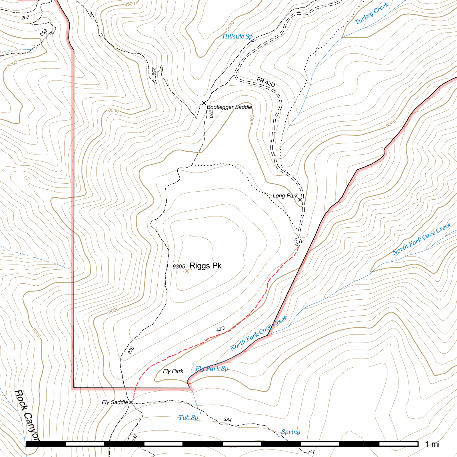
Long Park Trail #42D
Current Conditions
As of July 2025, Wild Arizona's Youth Conservation Corps has brushed, repaired and widened tread along the Long Park Trail. It is clear of deadfall.
Length: 0.68 mi
Difficulty: easy
Condition: good
Elevation range: 8965 ft – 9045 ft
Access
The Long Park Trail is accessible from two locations.
The northeastern terminus leaves the southeastern edge of the turnaround loop at the end of the Long Park Road (FR 42D), two miles beyond Rustler Park. This road is steep, narrow and very rough. High clearance vehicles with good off road tires are necessary and 4WD is recommended. You may wish to simply walk the road. Several signs mark the trailhead at the end of the road, including a kiosk.
The southwestern terminus connects to the five-way junction at Fly Saddle, along with the Crest Trail in two directions, Fly Peak Trail and Centella Trail. All four trails in this junction are signed.
Trail Description
From the turnaround loop at the end of the Long Park Road (FR 42D), the Long Park Trail heads south-southwest through a thick stand of pines, firs and spruce. While this area burned in 2011's Horseshoe 2 fire, it largely did not affect the canopy here except in small patches. After three tenths of a mile, the trail exits conifer cover into a clearing as it angles more to the southwest and passes above Fly Park through lovely shaded corridors of young aspen. 1000 feet later, you'll pass under a small stand of conifers again as the trail turns back to the south over a 500 foot stretch. When it exits the clearing it's 350 feet nearly straight south to Fly Saddle, a five-way junction with two segments of the Crest Trail, the Centella Trail and the Fly Peak Trail. The Wilderness boundary is crossed shortly before reaching Fly Saddle.
Map
Last updated July 14, 2025.