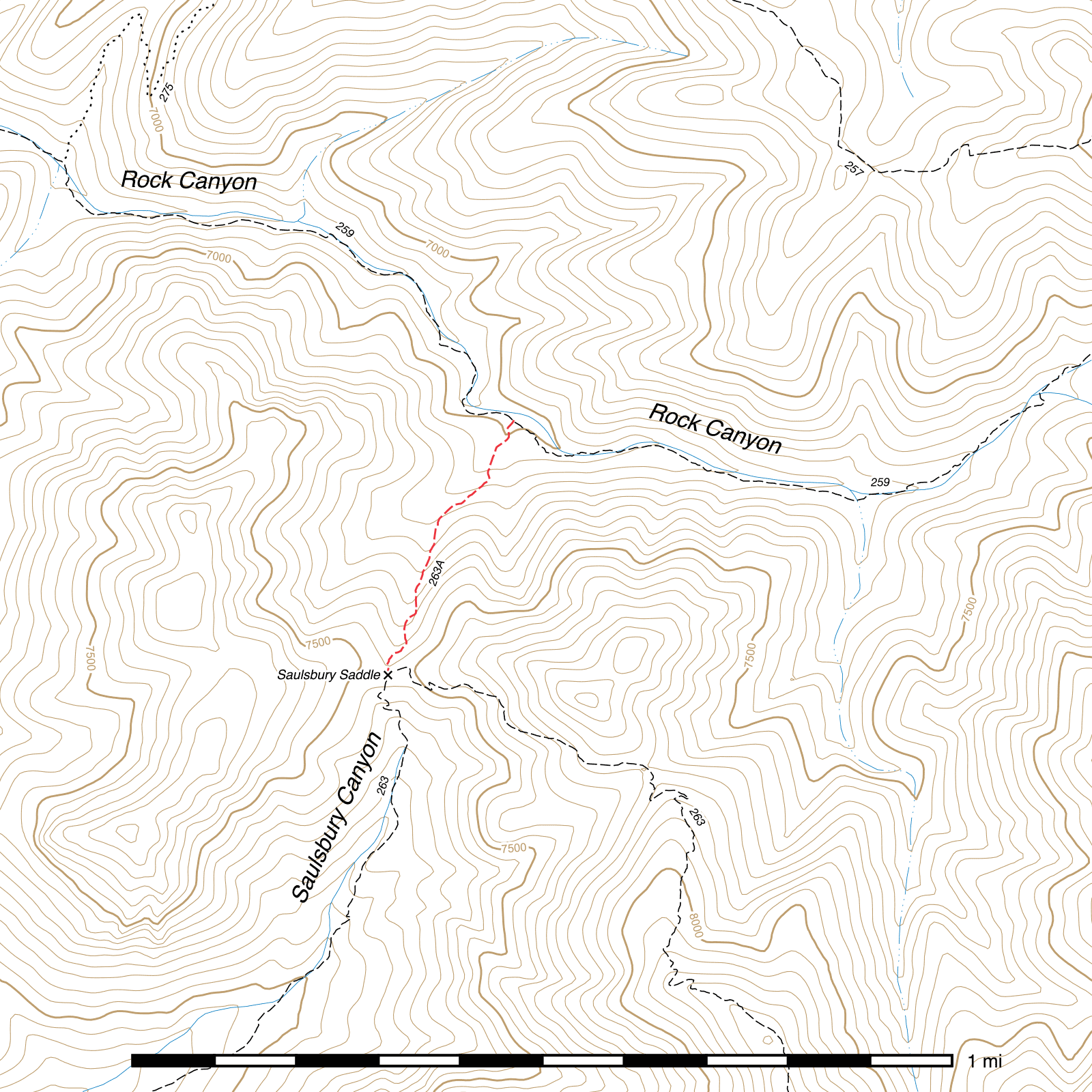
Saulsbury Saddle Trail #263A
Important Note
The signs at both ends of this trail list its number as #263A rather than #377, which most maps show. This guide is using the number from the signs.
The sign at Saulsbury Saddle appears to suggest the Saulsbury Saddle Trail continues from the north down the south side of Saulsbury Saddle all the way out to West Turkey Creek and the Saulsbury Trail begins at the saddle instead of West Turkey Creek. The older sign at the West Turkey Creek trailhead says otherwise, and this guide follows that interpretation.
Current Conditions
As of February 2026, this trail has been reported to be in mostly good condition.
Length: 0.43 mi
Difficulty: difficult
Condition: good
Elevation range: 7010 ft – 7430 ft
Access
The Saulsbury Saddle Trail is accessible from two locations.
The lower elevation northern terminus is in Rock Canyon along the Rock Creek Trail, (31.88987, -109.31253) 1.85 miles west-southwest of Rock Saddle. Most maps incorrectly show the north end of the trail angling to the northeast and connecting into the Rock Creek Trail approximately 0.1 mile east of the actual junction. The true junction is very visible and marked with a good sign.
The higher elevation southern terminus is at Saulsbury Saddle along the Saulsbury Trail. (31.88459, -109.31508) This junction is also marked by a sign.
Trail Description
From its junction with the Rock Creek Trail, (31.88988, -109.31251) the Saulsbury Saddle Trail heads south-southwest, beginning to climb almost immediately. This connector trail is fairly short and straightforward to follow, but it is very steep, with no switchbacks, and you may need to stop frequently to catch your breath. Climbing up a small canyon, the trail remains on the east side of the drainage until it reaches the top. Rock cairns may be found along the route, but they are generally unnecessary. Approaching the saddle, grass and weeds may obscure the exact path, but the sign should prove a good landmark for finding the junction with the Saulsbury Trail. (31.88373, -109.31427)
Map

Last updated February 10, 2026.