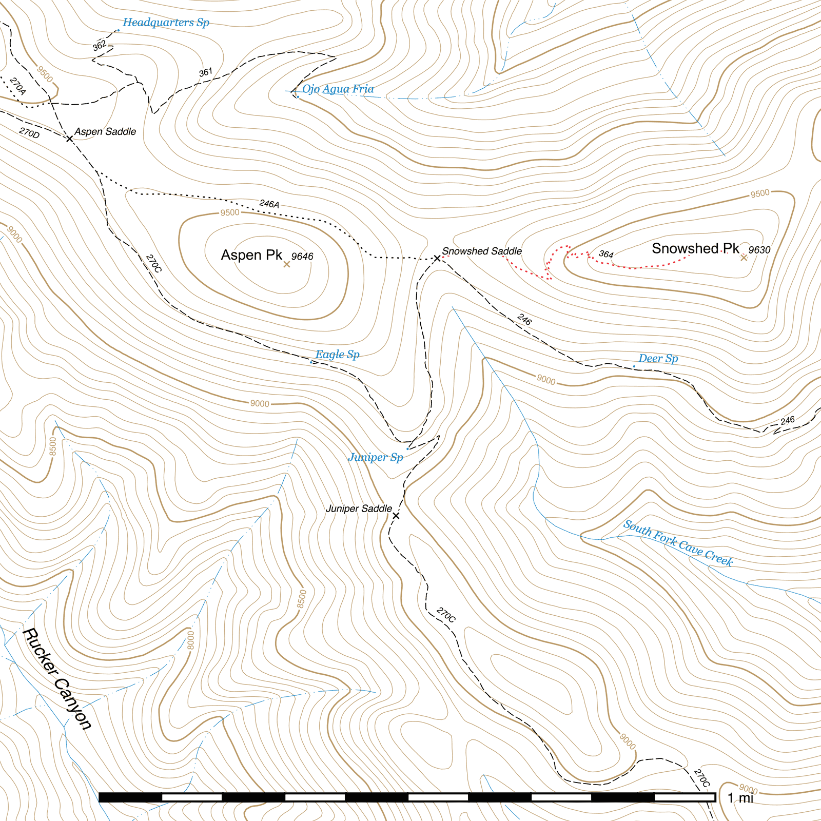
Snowshed Peak Trail #364
Current Conditions
This trail was cleared of deadfall and brushed sometime around 2023, so may be more navigable than in the past.
Length: 0.68 mi
Difficulty: easy
Condition: bad
Elevation range: 9280 ft – 9640 ft
Access
The Snowshed Peak Trail is accessible from Snowshed Saddle along the Snowshed Trail, (31.83887, -109.27571) 0.38 mile north of the Crest Trail junction at Juniper Spring, and 3 miles above Pine Park. The Snowshed Peak Trail junction is not marked by a sign and the trail is faint here. Watch for rock cairns.
Trail Description
The majority of this trail, but especially the Snowshed Saddle region, has been tremendously damaged by fire, and as a result, the initial 900 foot stretch of this trail is difficult to see. From Snowshed Saddle, (31.83887, -109.27581) head east-northeast for 360 feet before curving roughly east (31.83911, -109.27467) for 200 feet and then southeast (31.83900, -109.27407) for another approximately 350 feet. You should begin to pick up a faint trail here. (31.83842, -109.27314) After another 160 feet, still heading southeast, you will come to the first switchback and turn northwest. (31.83828, -109.27266)
Around this point, the trail may be heavily overgrown in many places. Aspen trees three inches in diameter have been growing right in the middle of the trail in the past, interspersed with the trunks and branches of fallen trees, creating a tangled mess that can be difficult to get through. While the trail itself and its switchbacks are often quite visible due to its frequent passage through scree fields and being lined with large rocks, the overgrowth and debris make it challenging to continue in places, and can hide the trail quite often as well.
Four more switchbacks occur over the next 300 feet, the trail moving generally north-northwest and only switching back briefly to the southeast to gain elevation. After the fourth, (31.83873, -109.27270), there is a longer stretch that climbs gradually, heading north initially and curving to the east-northeast until it comes to a final section of switchbacks, (31.83923, -109.27214) eight this time over the next 0.1 mile.
After exiting the last switchback, (31.83886, -109.27152) the trail heads southeast but arcs east and then northeast over the next 0.17 mile as it gradually climbs to a nicely forested saddle—a striking contrast to most of the rest of Snowshed Peak, so badly burned. This spot is somewhat sheltered, shaded, and has enough flat areas to be a potential campsite. (31.83904, -109.26878) The trail can briefly be a little difficult to spot from here, but it heads due east out of the saddle, climbing slightly for a moment, and runs out the remaining 470 feet to the true peak. (31.83889, -109.26735) There is a spectacular view of the Snowshed Trail below and the South Fork of Cave Creek beyond.
Map

Last updated July 17, 2025.