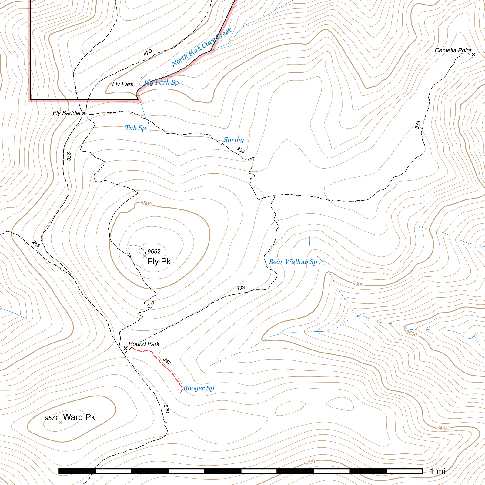
Booger Spring Trail #347
Important Note
Some sources use #347 to refer to this trail, while others use #374. The new sign at its junction with the Bear Wallow Trail calls it #347, and that is the number this guide will use.
Length: 0.22 mi
Difficulty: moderate
Condition: moderate
Elevation range: 9140 ft – 9240 ft
Access
The Booger Spring Trail is accessible via the Bear Wallow Trail in Round Park.
160 feet northeast from the Crest Trail along the Bear Wallow Trail, the grassy meadow of Round Park extends to the southeast. (31.86871, -109.28440) The Booger Spring Trail is not always immediately visible at this location, but a sign points you in the right direction and the trail becomes visible shortly after.
Trail Description
This trail is fairly visible once past the edge of Round Park, but it is somewhat rough in places and there may be occasional small debris and overgrowth across it.
After a gradual curve to the left exiting the meadow, you will swing back to the right and maintain a nearly constant southeastern course through moderately open terrain, full size trees only standing intermittently. 700 feet later, the trail angles to the south. Booger Spring lies 80 feet beyond. You will come to the concrete trough first, but fresh water is not flowing into it. A short distance beyond, the actual spring can be found. (31.86658, -109.28212) In wetter seasons, water is often leaking out around the cement lid and draining down the canyon, but in summer you may need to lift the lid and get water from inside. This spring is the headwaters of Greenhouse Creek.
Many old maps show this trail continuing beyond here to form a half circle and connect back to the Crest Trail at Wattmid Ridge, but there is virtually no evidence of this anymore and it has been officially abandoned by the Forest Service.
Map

Last updated July 13, 2025.