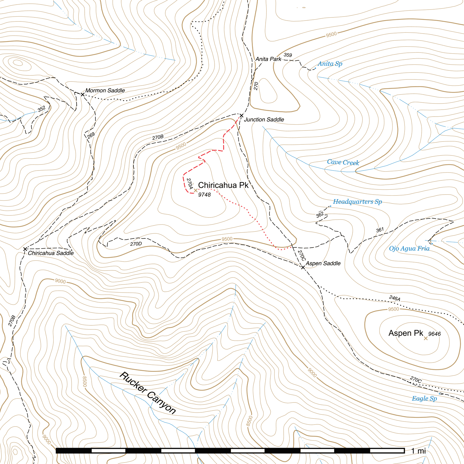
Chiricahua Peak Trail #270A
Current Conditions
As of July 2025, this trail is free of deadfall and in good condition.
Length: 0.42 mi
Difficulty: moderate
Condition: good
Elevation range: 9450 ft – 9740 ft
Access
The Chiricahua Peak Trail is accessible via Junction Saddle, (31.84959, -109.28897) a four-way junction where the three legs of the Crest Trail meet. Junction Saddle is 4.86 miles south along the northern leg of the Crest Trail from the junction just above Rustler Park, 2.23 miles northeast from the terminus of the southwestern leg of the Crest Trail at the Turtle Mountain Trail just below Monte Vista Peak, and 4.94 miles northwest from the terminus of the southeastern leg of the Crest Trail at Sentinel Peak.
A faint, abandoned southeastern route to the peak leaves the southeastern leg of the Crest Trail at Aspen Saddle, directly across from the signed junction with the Ojo Agua Fria Trail. (31.84315, -109.28646)
History
Chiricahua Peak was once named Round Mountain due to the fact that it's a small, rounded bump atop the crest of the Chiricahuas and not immediately obvious as the highest point.
Trail Description
From Junction Saddle, take the central fork angling to the southwest. The northwestern side of Chiricahua Peak burned in the Horseshoe 2 fire of 2011, and most of the trail is now fully exposed with little to no tree cover. The trail switchbacks several times as it climbs to the peak, and reenters the trees 400 feet from the peak itself. The top is still shaded with live trees and can provide a great lunch spot or campsite. A USGS benchmark marks the summit. (31.84593, -109.29123) A short walk to the north reveals a great view that wasn't visible before the fire opened up the tree cover.
A faint, abandoned portion of the trail (not included in the trail length or elevation change) heads down to Aspen Saddle from just before the summit. (31.84585, -109.29126) Follow the spine of the ridge down for approximately 1000 feet until you start to pick up more visible tread angling to the south. (31.84446, -109.28831) Follow this for 100 feet to a switchback, where the trail turns approximately east. (31.84417, -109.28831) Continue to follow it 140 feet to another bend in the trail, turning south again. (31.84407, -109.28788) Over the last 0.13 mile, the trail drops down off the spine of the ridge and contours around the south slope, curving southeast, then east until it connects with the Crest Trail at the signed Ojo Agua Fria Trail junction. (31.84315, -109.28646)
Map

Last updated July 13, 2025.