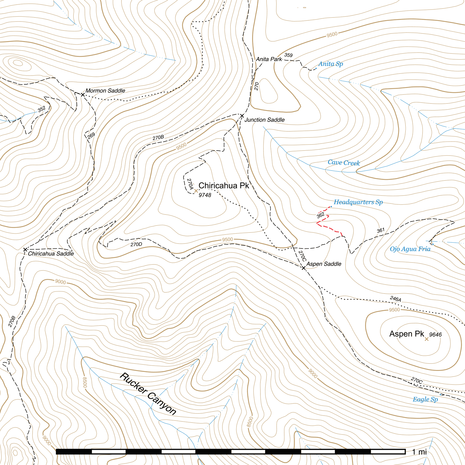
Headquarters Spring Trail #362
Current Conditions
As of July 2025, this trail has 46 trees down on it and has not yet been cleared this season.
The springbox at Headquarters Spring has not been reliably capturing water since at least 2019, and recent dry conditions have also reduced flow. Be prepared to use alternate water sources in the area, such as Eagle Spring or Ojo Agua Fria, but also check 15 to 20 feet below the Headquarters springbox for a possible natural pool.
Length: 0.21 mi
Difficulty: moderate
Condition: moderate
Elevation range: 9225 ft – 9400 ft
Access
The Headquarters Spring Trail is accessible via the Ojo Agua Fria Trail. After following it 0.15 mile east from the Crest Trail, head north when the Ojo Agua Fria Trail makes a sharp bend to the south-southeast. This junction is marked by a sign bolted to a tree. (31.84369, -109.28420)
History
The junction where this trail leaves the Ojo Agua Fria Trail was the site of the early Forest Service Headquarters for the Chiricahuas, with a cabin, stables and lookout tree. The lookout tree and the metal spikes driven into it for climbing can still be seen, now burned and fallen, lying just beyond the junction. The Headquarters Spring Trail passes right through part of the foundation of one of the structures. After the establishment of the Wilderness Act, the buildings, by that time likely long disused, were dismantled and removed.
Trail Description
Just before the Ojo Agua Fria Trail makes its first switchback to the right, (31.84369, -109.28420) head north to the site of the old Forest Service Headquarters buildings. The trail passes through the concrete foundations over the next 80 feet before heading roughly northwest. Three switchbacks through many fallen trees follow, and the metal spring box of the style used at Burnt Stump and Ida Peak Springs is 225 feet northeast of the last switchback. (31.84517, -109.28462) The spring was once quite reliable, especially in the spring and fall, but since at least 2019 has no longer been flowing properly into the box. Water may be found downhill of the box in natural pools. This area burned fairly heavily in 2011 and there a lot of standing dead, so expect downed trees for quite a while. If in doubt about the route of the trail, you can generally follow the cut logs down.
Map
Last updated July 13, 2025.